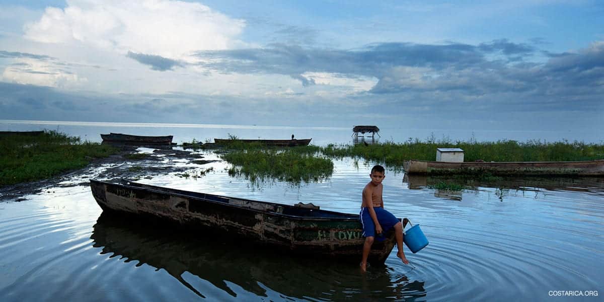
Lake Nicaragua
Central America's largest lake holds 365 islets off Granada, the twin volcanoes of Ometepe, the Solentiname islands and the Río San Juan, which carries its water to the Caribbean.
At a glance
- Fly into: Managua (MGA). Augusto C. Sandino airport is the starting point; Granada, Ometepe and San Carlos are reached from there by road, ferry or small plane.
- Best weather: November to April. Nicaragua's dry season; the heaviest rain falls in September and October.
- Pairs with: Granada, Ometepe and Río San Juan. Each has its own page: the colonial city on the shore, the island of two volcanoes and the river to the Caribbean.
Why visit Lake Nicaragua
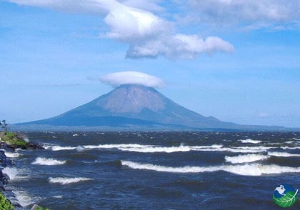
Lake Nicaragua is the largest lake in Central America and the tenth largest in the Americas. Indigenous peoples called it Cocibolca, and Nicaraguans still call it Mar Dulce, the Sweet Sea. Hundreds of volcanic islands and islets sit in its water, and the ones worth a journey are very different from each other. Las Isletas are 365 small volcanic islands just southeast of Granada, easy to see from a boat or a kayak. Ometepe is one island built by two volcanoes: Concepción, which is still active, and Maderas, which rises to 1,394 metres and holds a lagoon in its crater. In the southeast, the Solentiname archipelago can be reached only by boat, has no motorised traffic and has been known for primitivist painting since the 1960s. The lake empties through the Río San Juan into the Caribbean, the route scientists think bull sharks took to reach fresh water. Plan the lake as a set of separate stops, each with its own way in: road, ferry, small plane or river boat.
Volcanoes and forest
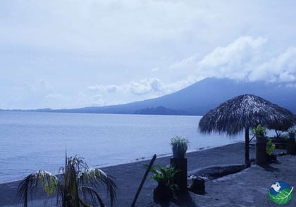
Ometepe's two volcanoes, its rainforest and petroglyphs on Maderas that date back 1,700 years.
Islets and wildlife
Boat and kayak tours through Las Isletas, with close views of Mombacho.
Art and river
Solentiname's painters and petroglyphs, then the Río San Juan on its way to the Caribbean.
Places to know
Granada
Founded in 1524, the oldest continuously inhabited city in Central America, at the western end of the lake and the starting point for Las Isletas.
Las Isletas
365 small volcanic islands just southeast of Granada, seen by boat or kayak on tours that generally run from 1 to 4 hours.
Ometepe
An island of two volcanoes and a biosphere reserve of rainforest and wetlands, reached by ferry from San Jorge.
Solentiname
An archipelago in the lake's southeast corner, reached only by boat and known for primitivist painting and petroglyphs.
San Carlos
The river town that is the gateway to Solentiname and the Río San Juan.
El Castillo
A small town on the Río San Juan with a Spanish fort and no road in, reached only by boat.
When to go
Nicaragua's dry season runs from November to April, the easiest time for volcano hikes and boat days on the lake. Rain is heaviest in September and October, and Ometepe's trails turn muddy in the wet months. Ferry crossings can be choppy, so early departures are the smoother ones.
Getting there and around
From Managua airport (MGA) to Granada
By road. Granada is the gateway to Las Isletas. We confirm the transfer time for your arrival day when we plan the trip.
From Managua airport to San Jorge (for Ometepe)
About 2.5 hours. Private transport to the port near Rivas, then a ferry of about 1 hour to Moyogalpa. There is no ferry from Granada to Ometepe.
From Managua to San Carlos
About 1 hour by air. By small plane. Schedules change, so we confirm them. The road is much longer.
From San Carlos to Solentiname
By boat. Shared boats run on set days and private boats can be hired. Crossing times vary by source, so we confirm them.
From San Carlos to El Castillo
By boat. No road reaches El Castillo. Boats leave San Carlos and travel down the Río San Juan.
Frequently asked questions
How many days should I plan for Lake Nicaragua?
The lake is several separate stops, so the answer depends on which you choose. Boat tours of Las Isletas generally run from 1 to 4 hours, which fits into a stay in Granada. Ometepe needs a ferry of about 1 hour each way, and one guide allows at least 8 hours for a volcano hike. For the Río San Juan with Solentiname and El Castillo, one operator suggests a minimum of 4 nights.
Can I take a boat from Granada to Ometepe?
A 2025 guide reports no current service from Granada. The ferries to Ometepe leave from San Jorge, near Rivas, and take about 1 hour to Moyogalpa. From Managua airport the drive to San Jorge is about 2.5 hours by private transport.
Are there really sharks in Lake Nicaragua?
Yes, bull sharks. A University of Nebraska team tagged more than 2,200 of them in 1968 and 1969, in the lake, at the mouth of the Río San Juan and at nearby river mouths, and found that they do not breed in the lake. A commercial shark fishery worked the lake from the 1960s to the 1980s, and bull sharks are now present but uncommon.
When is the best time to visit?
The dry season runs from November to April, and the driest months are December to April. September and October bring the heaviest rain. Ometepe's volcano trails are easiest to hike on dry days.
Is Solentiname hard to reach?
The islands can be reached only by boat, and the boats leave from San Carlos, which is reached by small plane from Managua or by a long road journey. There is no motorised traffic on the islands, so you walk or go by boat between them. We plan the connections as part of your itinerary.
What does the US government say about travel to Nicaragua?
The US Department of State advisory for Nicaragua is Level 3, Reconsider travel, issued May 14, 2026. The page lists a risk of wrongful detention and recommends travel insurance. Read the full advisory at https://travel.state.gov/en/international-travel/travel-advisories/nicaragua.html before you book, and check your own government's advice if you are not a US citizen.
Gallery
Location
Lake Nicaragua
Lake Nicaragua, Central America's largest lake: Las Isletas, Ometepe's two volcanoes, Solentiname and the Río San Juan, with how to get there and when to go.